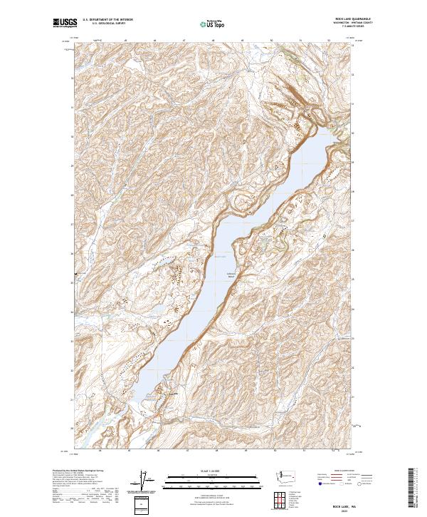
2023 Map of Rock Lake
USGS Topo · Published 2023About this map
Rock Lake dominates the center of this landscape, its elongated reach flanked by numerous smaller water bodies and the winding course of Kamiache Creek. The settlement of Lavista sits near the southwestern shore of the lake, adjacent to Lavista Lake and the inlet known as the Arm. The terrain is characterized by a series of basins and depressions that hold seasonal or permanent water, such as Alkali Lake, Tule Lake, and Egg Pond.
Find a feature on this map
40 named features on this map. Tap any name to fly to it.
Don’t see what you’re looking for? This feature index may not catch every label — zoom into the map to look around manually.
Map Details
Editions of this 2023 Rock Lake Map
This is the sole edition of this map. No revisions or reprints were ever made.
Other maps of this area

1954 · Cheney
USGS Topo · 1:62,500

1954 · Sprague
USGS Topo · 1:62,500

1955 · Spokane
USGS Topo · 1:250,000

1958 · Spokane
USGS Topo · 1:250,000

1964 · Lamont NE
USGS Topo · 1:24,000

1964 · St. John
USGS Topo · 1:24,000

1964 · Rock Lake
USGS Topo · 1:24,000

1964 · Texas Lake
USGS Topo · 1:24,000

1964 · Pine City
USGS Topo · 1:24,000

1964 · Ewan
USGS Topo · 1:24,000