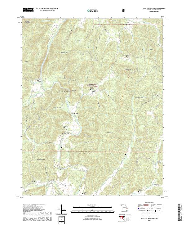
2021 Map of Rock Pile Mountain
USGS Topo · Published 2021About this map
Saint Francis River and its various tributaries carve through this portion of the Saint Francois Mountains, a landscape defined by deep hollows and named ridges. Small settlements like French Mills and Faro are located along these watercourses, while the southern reaches feature the community of Jewett. The area is characterized by a significant number of family and community burial grounds, such as Shoemaker Cem and Mount Pisgah Cem, reflecting the deep-rooted local history within Mark Twain National Forest. Local navigation once relied on crossings like Wide Ford and distinctive fishing spots like The Fish Trap on the river. Many of the landforms bear the names of early residents or descriptive identifiers, from Arnett Mtn and Bill Smith Hollow to the eponymous Rock Pile Mtn.
Find a feature on this map
81 named features on this map. Tap any name to fly to it.
Don’t see what you’re looking for? This feature index may not catch every label — zoom into the map to look around manually.
Map Details
Editions of this 2021 Rock Pile Mountain Map
This is the sole edition of this map. No revisions or reprints were ever made.
Other maps of this area

1926 · Des Arc
USGS Topo · 1:62,500

1929 · Des Arc
USGS Topo · 1:62,500

1930 · Coldwater
USGS Topo · 1:62,500

1937 · Ironton
USGS Topo · 1:48,000

1939 · Fredericktown
USGS Topo · 1:48,000

1945 · Ironton
USGS Topo · 1:62,500

1946 · Ironton
USGS Topo · 1:62,500

1947 · Fredericktown
USGS Topo · 1:62,500

1949 · Rolla
USGS Topo · 1:250,000

1949 · Coldwater
USGS Topo · 1:62,500