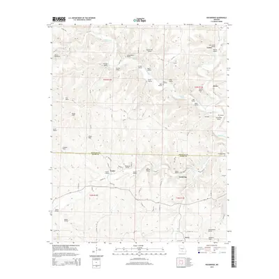
2015 Map of Rockbridge
USGS Topo · Published 2015About this map
Bryant Creek carves a deep path through this portion of the Ozark Plateau, where the border between Douglas County and Ozark County follows the high ground of Douglas Ridge. The landscape is defined by an intricate network of named hollows and ridges, many bearing the names of early local families such as John Smith Hollow, Harvey Hollow, and Eli Hollow. The settlement of Rockbridge serves as a focal point near the confluence of Brixey Creek and Spring Creek, while smaller communities like Souder and Bertha are tucked away along the winding county road system. Notable terrain features like Devils Backbone and Walker Knob punctuate the ridges, illustrating the complex topography of this rural region. The map also identifies local landmarks for genealogists, including the Yates Cemetery and several natural water sources like Columbus Spring and Coon Den Spring.
Find a feature on this map
91 named features on this map. Tap any name to fly to it.
Don’t see what you’re looking for? This feature index may not catch every label — zoom into the map to look around manually.
Map Details
Editions of this 2015 Rockbridge Map
This is the sole edition of this map. No revisions or reprints were ever made.
Other maps of this area

1934 · Gainesville
USGS Topo · 1:48,000

1936 · Thornfield
USGS Topo · 1:48,000

1936 · Ava
USGS Topo · 1:48,000

1937 · Buckhart
USGS Topo · 1:48,000

1940 · Gainesville
USGS Topo · 1:62,500

1942 · Ava
USGS Topo · 1:62,500

1943 · Thornfield
USGS Topo · 1:62,500

1943 · Buckhart
USGS Topo · 1:62,500

1945 · Ava
USGS Topo · 1:62,500

1945 · Harrison
USGS Topo · 1:250,000