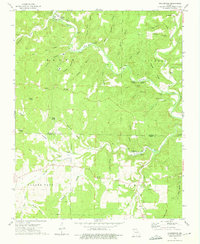
1973 Map of Rockbridge
USGS Topo · Published 1975About this map
Bryant Creek and the Barren Fork define the drainage patterns of this Ozark landscape, which transitions between Douglas and Ozark counties. The settlement of Rockbridge serves as a focal point near the confluence of Spring Creek and Bryant Creek, featuring a Fish Hatchery that points to the importance of the local spring system. To the north, the Rippee State Wildlife Management Area encompasses the sharp bend of Rippee Creek near the prominent Devils Backbone ridge.
Find a feature on this map
56 named features on this map. Tap any name to fly to it.
Don’t see what you’re looking for? This feature index may not catch every label — zoom into the map to look around manually.
Map Details
Editions of this 1973 Rockbridge Map
This is the sole edition of this map. No revisions or reprints were ever made.
Other maps of this area

1934 · Gainesville
USGS Topo · 1:48,000

1936 · Thornfield
USGS Topo · 1:48,000

1936 · Ava
USGS Topo · 1:48,000

1937 · Buckhart
USGS Topo · 1:48,000

1940 · Gainesville
USGS Topo · 1:62,500

1942 · Ava
USGS Topo · 1:62,500

1943 · Thornfield
USGS Topo · 1:62,500

1943 · Buckhart
USGS Topo · 1:62,500

1945 · Ava
USGS Topo · 1:62,500

1945 · Harrison
USGS Topo · 1:250,000