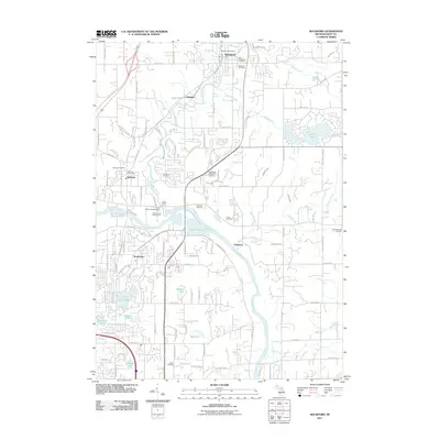
2011 Map of Rockford
USGS Topo · Published 2011About this map
The Rogue River and Grand River converge in this northern Kent County landscape, shaping a corridor of settlements from Rockford down toward the outskirts of Grand Rapids. This 2011 survey illustrates the modern transition of historic riverside towns like Childsdale and Chauncey into a suburban landscape defined by recreational and residential growth. Genealogists and local historians will find a high concentration of burial grounds, including the Old Rockford Cemetery, Blythefield Memorial Gardens, and the Friant Cemetery, providing a clear record of local family lineages. The map also documents significant recreational infrastructure, such as the Cannonsburg Ski Area, the Grand Rogue Campgrounds, and the White Pine Trl which follows a legacy rail corridor through the heart of Rockford. A series of small lakes, including Versluis Lake and Dunlop Lake, dot the terrain between the primary river valleys.
Find a feature on this map
48 named features on this map. Tap any name to fly to it.
Don’t see what you’re looking for? This feature index may not catch every label — zoom into the map to look around manually.
Map Details
Editions of this 2011 Rockford Map
This is the sole edition of this map. No revisions or reprints were ever made.
Other maps of this area

1914 · Grand Rapids
USGS Topo · 1:62,500

1918 · Cedar Springs
USGS Topo · 1:62,500

1918 · Lowell
USGS Topo · 1:62,500

1943 · Cedar Springs
USGS Topo · 1:62,500

1943 · Grand Rapids
USGS Topo · 1:62,500

1943 · Lowell
USGS Topo · 1:62,500

1954 · Midland
USGS Topo · 1:250,000

1958 · Midland
USGS Topo · 1:250,000

1958 · Grand Rapids
USGS Topo · 1:250,000

1959 · Midland
USGS Topo · 1:250,000