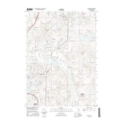
2017 Map of Rockford
USGS Topo · Published 2017About this map
The Rogue River flows through the heart of Rockford, marking a landscape where the river's path once drove the local economy. In this 2017 edition, the area’s growth is evident as Grand Rapids expands northward, connecting the established communities of Belmont and Northview through a dense network of suburban development and recreation corridors. The Fred Meijer White Pine Trail State Park follows a former rail line through the center of the sheet, providing a modern recreational use for historic transportation routes.
Find a feature on this map
61 named features on this map. Tap any name to fly to it.
Don’t see what you’re looking for? This feature index may not catch every label — zoom into the map to look around manually.
Map Details
Editions of this 2017 Rockford Map
This is the sole edition of this map. No revisions or reprints were ever made.
Other maps of this area

1914 · Grand Rapids
USGS Topo · 1:62,500

1918 · Cedar Springs
USGS Topo · 1:62,500

1918 · Lowell
USGS Topo · 1:62,500

1943 · Cedar Springs
USGS Topo · 1:62,500

1943 · Grand Rapids
USGS Topo · 1:62,500

1943 · Lowell
USGS Topo · 1:62,500

1954 · Midland
USGS Topo · 1:250,000

1958 · Midland
USGS Topo · 1:250,000

1958 · Grand Rapids
USGS Topo · 1:250,000

1959 · Midland
USGS Topo · 1:250,000