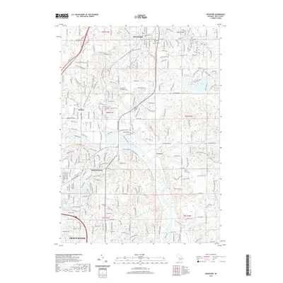
2019 Map of Rockford
USGS Topo · Published 2019About this map
The Grand River and its tributary, the Rogue River, dominate this landscape north of Grand Rapids. The suburban expansion of Northview and Belmont is documented alongside traditional rural landmarks such as Rockford Cem and the Plainfield Township Cem and Columbarium. The northern portion of the map shows the city of Rockford, while the eastern edge includes the protected woodlands of the Cannonsburg State Game Area. Genealogists will find several burial grounds, including the Friant Cem and Mason Cem, situated among the residential developments. The corridor of the Fred Meijer White Pine Trail State Park follows a former rail line, cutting through the terrain near several small lakes like Dunlop Lake and Shadow Lake, illustrating the area's transition from an industrial and agricultural hub into a recreational and residential extension of the greater Grand Rapids area.
Find a feature on this map
237 named features on this map. Tap any name to fly to it.
Don’t see what you’re looking for? This feature index may not catch every label — zoom into the map to look around manually.
Map Details
Editions of this 2019 Rockford Map
This is the sole edition of this map. No revisions or reprints were ever made.
Other maps of this area

1914 · Grand Rapids
USGS Topo · 1:62,500

1918 · Cedar Springs
USGS Topo · 1:62,500

1918 · Lowell
USGS Topo · 1:62,500

1943 · Cedar Springs
USGS Topo · 1:62,500

1943 · Grand Rapids
USGS Topo · 1:62,500

1943 · Lowell
USGS Topo · 1:62,500

1954 · Midland
USGS Topo · 1:250,000

1958 · Midland
USGS Topo · 1:250,000

1958 · Grand Rapids
USGS Topo · 1:250,000

1959 · Midland
USGS Topo · 1:250,000