2023 Map of Rockford
USGS Topo · Published 2023About this map
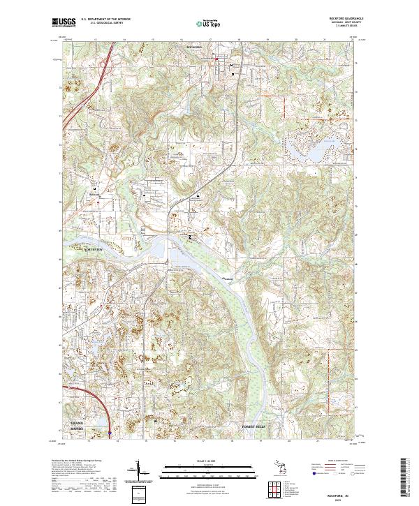
The Rogue River meanders through the heart of Rockford, eventually converging with the Grand River in this detailed survey of Kent County. The landscape is defined by its significant water systems and the established residential corridors of Northview, Belmont, and Forest Hills. Long-distance recreational infrastructure is prominent, with the Fred Meijer White Pine Trail State Park Trl following a former rail alignment and the North Country National Scenic Trl cutting across the northern sections. Genealogists will find a high density of burial sites documented, including the Plainfield Township Cem and Columbarium, Pioneer Cem, and Saint Mary's Cem. The map also illustrates the institutional footprint of Kuyper College and several distinct neighborhoods such as Chauncey that have integrated into the suburban landscape of northern Grand Rapids.
Find a feature on this map
48 named features on this map. Tap any name to fly to it.
Don’t see what you’re looking for? This feature index may not catch every label — zoom into the map to look around manually.
Map Details
Editions of this 2023 Rockford Map
This is the sole edition of this map. No revisions or reprints were ever made.