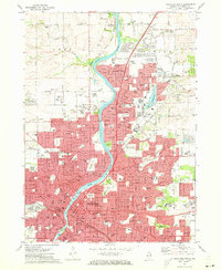
1971 Map of Rockford North
USGS Topo · Published 1973About this map
Rockford and its northern suburbs are defined by the winding course of the Rock River in this early 1970s topographic survey. The urban core of Rockford is dense with civic and social infrastructure, from the Courthouse and City Hall to numerous neighborhood landmarks like the Swedish-American Hospital and the sprawling Cedar Bluff Cemetery. To the north, the industrial and residential growth of Loves Park and North Park is visible, punctuated by the Machesney Airport and the Rockford Speedway. The landscape is a mix of established city blocks and expanding recreational spaces like Sinnissippi Park and Rock Cut State Park. The region's transport network is well-defined, featuring the Chicago Milwaukee St Paul and Pacific railroad and the Illinois Central lines that historically fueled the manufacturing economy of the Rock River Valley.
Find a feature on this map
124 named features on this map. Tap any name to fly to it.
Don’t see what you’re looking for? This feature index may not catch every label — zoom into the map to look around manually.
Map Details
Editions of this 1971 Rockford North Map
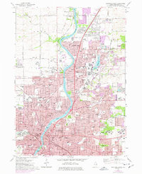
2 editions found
Other maps of this area

1917 · Kings
USGS Topo · 1:62,500

1918 · Rockford
USGS Topo · 1:62,500

1918 · Belvidere
USGS Topo · 1:62,500

1918 · Kings
USGS Topo · 1:62,500

1918 · Kirkland
USGS Topo · 1:62,500

1938 · Rockford
USGS Topo · 1:62,500

1944 · Belvidere
USGS Topo · 1:62,500

1949 · Camp Grant
USGS Topo · 1:24,000

1949 · Rockford
USGS Topo · 1:24,000

1954 · Rockford
USGS Topo · 1:250,000