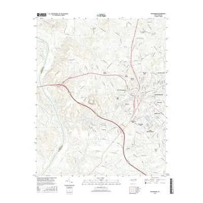
2016 Map of Rockingham
USGS Topo · Published 2016About this map
Rockingham serves as the focal point of this study, anchored by a network of suburban and industrial developments alongside the Pee Dee River. The landscape is defined by the hydrologic influence of Hitchcock Creek and its associated impoundments like Great Falls Pond and Steeles Mill Pond, which historically powered the local textile economy. Small residential pockets and former mill villages such as Cordova, Midway, and Honey Town surround the city center, while the Richmond County Airport occupies the southeastern reaches. Genealogists will find several burial grounds noted across the terrain, including Popular Springs Cem and the Northam Cem near the northern boundary. The bypass of Highway 74 cuts through the center of the sheet, illustrating modern transportation shifts away from the older river-oriented settlement patterns.
Find a feature on this map
190 named features on this map. Tap any name to fly to it.
Don’t see what you’re looking for? This feature index may not catch every label — zoom into the map to look around manually.
Map Details
Editions of this 2016 Rockingham Map
This is the sole edition of this map. No revisions or reprints were ever made.
Other maps of this area

1942 · Troy
USGS Topo · 1:125,000

1942 · Rockingham
USGS Topo · 1:125,000

1949 · Millstone Lake
USGS Topo · 1:24,000

1949 · Ghio
USGS Topo · 1:24,000

1949 · Hamlet
USGS Topo · 1:24,000

1949 · Hamlet
USGS Topo · 1:62,500

1949 · Jackson Springs
USGS Topo · 1:62,500

1953 · Florence
USGS Topo · 1:250,000

1953 · Raleigh
USGS Topo · 1:250,000

1954 · Florence
USGS Topo · 1:250,000