2022 Map of Rockingham
USGS Topo · Published 2022About this map
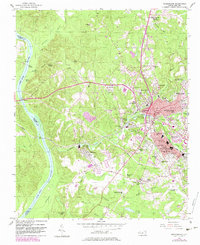
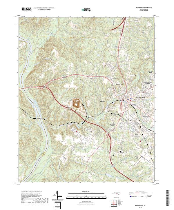
Rockingham serves as the focal point of this Richmond County corridor, where the urban landscape meets the winding waters of the Pee Dee River. The modern transport network is defined by the bifurcation of Bus 74 and Byp 74, which skirt around the historic town center and the Richmond County Judicial Center. Surrounding the city, a constellation of residential and industrial pockets like West Rockingham, East Rockingham, and the riverside community of Cordova illustrate the area's twentieth-century growth patterns. The landscape is deeply carved by drainage systems including Hitchcock Creek and Falling Cr, which have historically influenced the placement of neighborhoods like Maplewood and Glenwood. Genealogists will find significant value in the distribution of family and community burial grounds, from Northam Cem in the north to the Mispah Cem near the southern boundary, alongside longstanding spiritual anchors such as Sandy Grove Church.
Find a feature on this map
198 named features on this map. Tap any name to fly to it.
Don’t see what you’re looking for? This feature index may not catch every label — zoom into the map to look around manually.
Map Details
Editions of this 2022 Rockingham Map
This is the sole edition of this map. No revisions or reprints were ever made.
Historical Maps of Maplewood Through Time
4 maps found