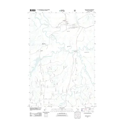
2011 Map of Rockland
USGS Topo · Published 2011About this map
The Ontonagon River and its multiple branches define the rugged topography of this copper-country landscape, where the settlement of Rockland serves as a central hub. Just to the south, the Old Victoria Historic Townsite preserves a significant mining legacy near Victoria and the Victoria Reservoir. The map documents a cluster of cemeteries near Rockland, including Woodlawn Cemetery, Methodist Rose Cemetery, and Irish Hollow Cemetery, which provide valuable location data for genealogists tracing early families of Ontonagon County.
Find a feature on this map
40 named features on this map. Tap any name to fly to it.
Don’t see what you’re looking for? This feature index may not catch every label — zoom into the map to look around manually.
Map Details
Editions of this 2011 Rockland Map
This is the sole edition of this map. No revisions or reprints were ever made.
Other maps of this area

1949 · Rockland
USGS Topo · 1:62,500

1950 · Greenland
USGS Topo · 1:62,500

1951 · Rockland
USGS Topo · 1:62,500

1951 · Greenland
USGS Topo · 1:62,500

1955 · Ontonagon
USGS Topo · 1:62,500

1956 · Matchwood
USGS Topo · 1:62,500

1958 · Iron River
USGS Topo · 1:250,000

1960 · Iron River
USGS Topo · 1:250,000

1961 · Iron River
USGS Topo · 1:250,000

1967 · Iron River
USGS Topo · 1:250,000