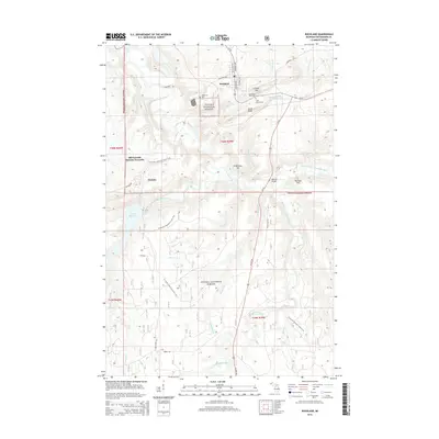
2014 Map of Rockland
USGS Topo · Published 2014About this map
Rockland and the nearby copper-mining legacy of Ontonagon County define this landscape within the Ottawa National Forest. The map documents a topography shaped by industrial heritage, featuring peaks like C-Shaft Hill and South Bluff that overlook the winding Ontonagon River. The Old Victoria Historic Townsite remains a primary landmark near the Victoria Reservoir, preserving the footprint of 19th-century mining life. Local genealogy is supported by the clear identification of three distinct burial grounds: Woodlawn Cem, Methodist Rose Cem, and Irish Hollow Cem. For hikers and nature enthusiasts, the N Country National Scenic Trail traverses the region, crossing various tributaries such as Puffy Cr and leading toward natural features like O Kun de Kun Falls in the southern portion of the quadrangle.
Find a feature on this map
53 named features on this map. Tap any name to fly to it.
Don’t see what you’re looking for? This feature index may not catch every label — zoom into the map to look around manually.
Map Details
Editions of this 2014 Rockland Map
This is the sole edition of this map. No revisions or reprints were ever made.
Other maps of this area

1949 · Rockland
USGS Topo · 1:62,500

1950 · Greenland
USGS Topo · 1:62,500

1951 · Rockland
USGS Topo · 1:62,500

1951 · Greenland
USGS Topo · 1:62,500

1955 · Ontonagon
USGS Topo · 1:62,500

1956 · Matchwood
USGS Topo · 1:62,500

1958 · Iron River
USGS Topo · 1:250,000

1960 · Iron River
USGS Topo · 1:250,000

1961 · Iron River
USGS Topo · 1:250,000

1967 · Iron River
USGS Topo · 1:250,000