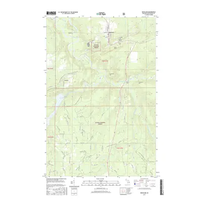
2017 Map of Rockland
USGS Topo · Published 2017About this map
Rockland and Victoria anchor this study of Ontonagon County, where the industrial legacy of Michigan's copper country is visible in the landscape. Mining heritage is explicitly marked at C Shaft Hill and the Irish Hollow Cem, while the historic Old-Indian- Burial Grounds north of the Ontonagon River point to a much deeper human presence. The landscape is defined by the sharp relief of South Bluff and N Military Hill, with the Victoria Reservoir and Kun de Kun Falls marking the descent of the region's complex river system. Modern recreational access is represented by the N Country National Scenic Trail, which winds through the Ottawa National Forest, connecting these former industrial centers through a network of forest roads like Burma Rd and Victoria Dam Rd.
Find a feature on this map
82 named features on this map. Tap any name to fly to it.
Don’t see what you’re looking for? This feature index may not catch every label — zoom into the map to look around manually.
Map Details
Editions of this 2017 Rockland Map
This is the sole edition of this map. No revisions or reprints were ever made.
Other maps of this area

1949 · Rockland
USGS Topo · 1:62,500

1950 · Greenland
USGS Topo · 1:62,500

1951 · Rockland
USGS Topo · 1:62,500

1951 · Greenland
USGS Topo · 1:62,500

1955 · Ontonagon
USGS Topo · 1:62,500

1956 · Matchwood
USGS Topo · 1:62,500

1958 · Iron River
USGS Topo · 1:250,000

1960 · Iron River
USGS Topo · 1:250,000

1961 · Iron River
USGS Topo · 1:250,000

1967 · Iron River
USGS Topo · 1:250,000