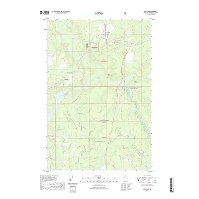
2019 Map of Rockland
USGS Topo · Published 2019About this map
Rockland and Victoria anchor this landscape within the Ottawa National Forest, where the copper mining heritage of the Upper Peninsula is written into the terrain. Distinctive features like C Shaft Hill and the bluffs near the Ontonagon River point to the area's industrial past, while the Victoria Reservoir and the Military Bridge highlight historical infrastructure. Genealogists can find several burial grounds, including Methodist Rose Cem, Irish Hollow Cem, and Woodlawn Cem, clustered near the northern settlements. The hydrography is dominated by the complex branches of the Ontonagon, including the Ontonagon-Wild and Scenic River corridor. Natural landmarks such as Kun de Kun Falls and Irish Rapid Falls mark the rugged descent of the local watershed through the forest, intersected by the N Country National Scenic Trail.
Find a feature on this map
53 named features on this map. Tap any name to fly to it.
Don’t see what you’re looking for? This feature index may not catch every label — zoom into the map to look around manually.
Map Details
Editions of this 2019 Rockland Map
This is the sole edition of this map. No revisions or reprints were ever made.
Other maps of this area

1949 · Rockland
USGS Topo · 1:62,500

1950 · Greenland
USGS Topo · 1:62,500

1951 · Rockland
USGS Topo · 1:62,500

1951 · Greenland
USGS Topo · 1:62,500

1955 · Ontonagon
USGS Topo · 1:62,500

1956 · Matchwood
USGS Topo · 1:62,500

1958 · Iron River
USGS Topo · 1:250,000

1960 · Iron River
USGS Topo · 1:250,000

1961 · Iron River
USGS Topo · 1:250,000

1967 · Iron River
USGS Topo · 1:250,000