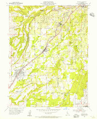
1954 Map of Rocklin
USGS Topo · Published 1955About this map
The Southern Pacific railroad corridor anchors the Sierra Nevada foothills in this mid-century survey, linking the fruit-growing and granite-quarrying centers of Rocklin, Loomis, Penryn, and Newcastle. The landscape is a complex network of industrial and agricultural water management, defined by numerous canals, flumes, and basins such as the Clover Valley Reservoir and Sicily Reservoir. Along the ridges and ravines, the map records the region's mining legacy through specific sites like the Alabama Mine, Mary Len Mine, and Highway 40 Mine, alongside various unnamed quarries near the Rocklin city boundary. A significant historical detail is the blue hatching near the North Fork American River, indicating the area slated for submergence by the Folsom Res following the completion of the Folsom Dam. This transition from a mining and rail landscape to one dominated by large-scale water storage is further evidenced by the smaller Roseville Reservoir and Rocklin Reservoir dotting the hillsides.
Find a feature on this map
33 named features on this map. Tap any name to fly to it.
Don’t see what you’re looking for? This feature index may not catch every label — zoom into the map to look around manually.
Map Details
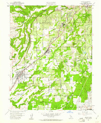
Editions of this 1954 Rocklin Map
2 editions found
Other maps of this area

1891 · Sacramento
USGS Topo · 1:125,000

1892 · Sacramento
USGS Topo · 1:125,000

1893 · Sacramento
USGS Topo · 1:125,000

1902 · Fairoaks
USGS Topo · 1:62,500

1910 · Lincoln
USGS Topo · 1:31,680

1910 · Roseville
USGS Topo · 1:31,680

1911 · Antelope
USGS Topo · 1:31,680

1914 · Folsom
USGS Topo · 1:31,680

1941 · Folsom
USGS Topo · 1:62,500
1942 · Markham Ravine
USGS Topo · 1:62,500