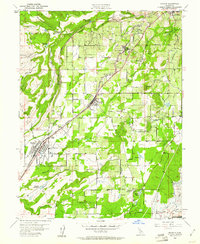
1954 Map of Rocklin
USGS Topo · Published 1961About this map
Southern Pacific railroad tracks anchor the development of Placer County in the mid-1950s, connecting a string of towns including Newcastle, Penryn, Loomis, and Rocklin. The landscape reveals a transition from industrial activity to emerging suburban pockets like Stallman Corners and Hidden Valley. Granite extraction and mining history are evident through numerous Quarries and named operations such as the Sicily Mine and Alabany Mine dotting the terrain.
Find a feature on this map
40 named features on this map. Tap any name to fly to it.
Don’t see what you’re looking for? This feature index may not catch every label — zoom into the map to look around manually.
Map Details
Editions of this 1954 Rocklin Map
2 editions found
Other maps of this area

1891 · Sacramento
USGS Topo · 1:125,000

1892 · Sacramento
USGS Topo · 1:125,000

1893 · Sacramento
USGS Topo · 1:125,000

1902 · Fairoaks
USGS Topo · 1:62,500

1910 · Lincoln
USGS Topo · 1:31,680

1910 · Roseville
USGS Topo · 1:31,680

1911 · Antelope
USGS Topo · 1:31,680

1914 · Folsom
USGS Topo · 1:31,680

1941 · Folsom
USGS Topo · 1:62,500
1942 · Markham Ravine
USGS Topo · 1:62,500