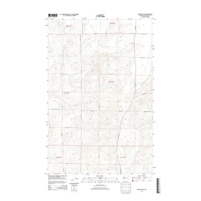
2013 Map of Rocklyn SE
USGS Topo · Published 2013About this map
Lincoln County farmland is meticulously detailed in this early 21st-century survey, revealing a landscape defined by the Public Land Survey System. The rectilinear grid of section lines is mirrored by a network of local roads that bear the names of established ranching and farming families. Landmarks such as Seven Springs Dairy Rd E and Church Rd E indicate the historical economic and social centers of this rural community. The map covers parts of Townships 23, 24, and 25 North, where the topography is primarily characterized by the drainage patterns and gentle elevations typical of the region. Transportation corridors like Rocklyn Rd N and Kupers Rd N connect remote homesteads, while specialized infrastructure is noted via Harrington Airport RD E. This survey provides a clear look at modern land use while preserving the nomenclature of the area's agricultural heritage.
Find a feature on this map
24 named features on this map. Tap any name to fly to it.
Don’t see what you’re looking for? This feature index may not catch every label — zoom into the map to look around manually.
Map Details
Editions of this 2013 Rocklyn SE Map
This is the sole edition of this map. No revisions or reprints were ever made.
Other maps of this area

1953 · Ritzville
USGS Topo · 1:250,000

1959 · Ritzville
USGS Topo · 1:250,000

1965 · Ritzville
USGS Topo · 1:250,000

1969 · Rocklyn SW
USGS Topo · 1:24,000

1969 · Bluestem
USGS Topo · 1:24,000

1969 · Harrington
USGS Topo · 1:24,000

1969 · Lords Valley
USGS Topo · 1:24,000

1969 · Cormana Lake
USGS Topo · 1:24,000

1969 · Telford
USGS Topo · 1:24,000

1969 · Rocklyn
USGS Topo · 1:24,000