
1969 Map of Harrington
USGS Topo · Published 1972About this map
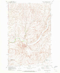
The town of Harrington serves as the focal point of this late-1960s survey, situated at the junction of the Burlington Northern railroad and several regional conduits. The landscape is defined by the winding course of Coal Creek and a network of agricultural and industrial infrastructure, including numerous Gravel Pits and Grain Elevators that highlight the local economy. To the southwest, the small settlement of Mohler sits along the rail line, marked by its own Elevator and a nearby Gaging Station.
Find a feature on this map
21 named features on this map. Tap any name to fly to it.
Don’t see what you’re looking for? This feature index may not catch every label — zoom into the map to look around manually.
Map Details
Editions of this 1969 Harrington Map
This is the sole edition of this map. No revisions or reprints were ever made.
Other maps of this area

1953 · Ritzville
USGS Topo · 1:250,000

1959 · Ritzville
USGS Topo · 1:250,000

1965 · Ritzville
USGS Topo · 1:250,000

1969 · Rocklyn SW
USGS Topo · 1:24,000

1969 · Bluestem
USGS Topo · 1:24,000

1969 · Lords Valley
USGS Topo · 1:24,000

1969 · Cormana Lake
USGS Topo · 1:24,000

1969 · Lamona
USGS Topo · 1:24,000
1969 · Sprague Lake SW
USGS Topo · 1:24,000
1969 · Rocklyn SE
USGS Topo · 1:24,000