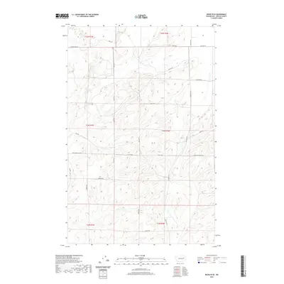
2020 Map of Rocklyn SE
USGS Topo · Published 2020About this map
Agricultural family lineages define the road network of this Lincoln County landscape, where routes like Seven Springs Dairy Rd and Old Kuchs Rd reflect decades of land use and tenure. The map detail is structured by the Public Land Survey System, spanning portions of Township 24 North across Ranges 35 and 36 East. While the terrain is primarily shaped by the undulating coulees and plateaus characteristic of the region, the placement of Church Rd E and Harrington Airport Rd indicates the proximity of essential community infrastructure. Researchers can trace the legacy of local settlers through the numerous family-named thoroughfares, such as Borgens Rd, Kloster Rd, and Kruger Rd E, which stitch together the vast patchwork of farmsteads and field boundaries that have persisted into the modern era.
Find a feature on this map
26 named features on this map. Tap any name to fly to it.
Don’t see what you’re looking for? This feature index may not catch every label — zoom into the map to look around manually.
Map Details
Editions of this 2020 Rocklyn SE Map
This is the sole edition of this map. No revisions or reprints were ever made.
Other maps of this area

1953 · Ritzville
USGS Topo · 1:250,000

1959 · Ritzville
USGS Topo · 1:250,000

1965 · Ritzville
USGS Topo · 1:250,000

1969 · Rocklyn SW
USGS Topo · 1:24,000

1969 · Bluestem
USGS Topo · 1:24,000

1969 · Harrington
USGS Topo · 1:24,000

1969 · Lords Valley
USGS Topo · 1:24,000

1969 · Cormana Lake
USGS Topo · 1:24,000

1969 · Telford
USGS Topo · 1:24,000

1969 · Rocklyn
USGS Topo · 1:24,000