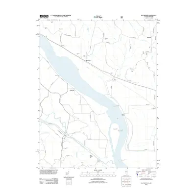
2012 Map of Rockwood
USGS Topo · Published 2012About this map
Rockwood sits at the heart of this riverfront landscape where the Mississippi River carves a complex path through the bottomlands. The river's influence is evident in the numerous chutes and islands, such as Rockwood Island and the shifting channels of Jones Cutoff. Landings like Allens Landing and Wagners Landing mark historical points of river transit, while the geography is further defined by Potato Bend and Grand Eddy. Away from the water, the terrain rises toward Saint Cosme Hill and is etched by numerous drainage systems including Degognia Cr and Cinque Hommes Cr.
Find a feature on this map
69 named features on this map. Tap any name to fly to it.
Don’t see what you’re looking for? This feature index may not catch every label — zoom into the map to look around manually.
Map Details
Editions of this 2012 Rockwood Map
This is the sole edition of this map. No revisions or reprints were ever made.
Other maps of this area

1915 · Chester
USGS Topo · 1:62,500

1916 · Campbell Hill
USGS Topo · 1:62,500

1918 · Altenburg
USGS Topo · 1:62,500

1918 · Campbell Hill
USGS Topo · 1:62,500

1923 · Perryville
USGS Topo · 1:62,500

1924 · Perryville
USGS Topo · 1:62,500

1925 · Altenburg
USGS Topo · 1:62,500

1947 · Chester
USGS Topo · 1:62,500

1947 · Crosstown
USGS Topo · 1:24,000

1947 · Altenburg
USGS Topo · 1:62,500