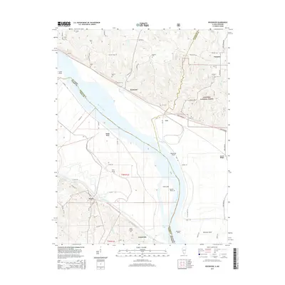
2015 Map of Rockwood
USGS Topo · Published 2015About this map
The Mississippi River creates a dynamic border between Illinois and Missouri, anchoring a landscape shaped by both alluvial bottoms and rising bluffs. In the north, the terrain of Pleasant Ridge and the eastern edge of the Shawnee National Forest contrast with the low-lying Bois Brule drainage district. This topography dictated the placement of small agricultural settlements like Rockwood, Degognia, and Menfro. The river corridor itself is marked by notable navigational and terrain features, including Liberty Bar, Potato Bend, and the large landmass of Crains Island. The prevalence of small family and community burial grounds, such as Kirk Cem, Isom Cem, and Hindman Cem, reflects a deep history of localized rural life across both riverbanks. Transportation networks follow the river's contour, with the Great River RD and Levee RD providing critical access to the fertile but flood-prone bottomlands.
Find a feature on this map
76 named features on this map. Tap any name to fly to it.
Don’t see what you’re looking for? This feature index may not catch every label — zoom into the map to look around manually.
Map Details
Editions of this 2015 Rockwood Map
This is the sole edition of this map. No revisions or reprints were ever made.
Other maps of this area

1915 · Chester
USGS Topo · 1:62,500

1916 · Campbell Hill
USGS Topo · 1:62,500

1918 · Altenburg
USGS Topo · 1:62,500

1918 · Campbell Hill
USGS Topo · 1:62,500

1923 · Perryville
USGS Topo · 1:62,500

1924 · Perryville
USGS Topo · 1:62,500

1925 · Altenburg
USGS Topo · 1:62,500

1947 · Chester
USGS Topo · 1:62,500

1947 · Crosstown
USGS Topo · 1:24,000

1947 · Altenburg
USGS Topo · 1:62,500