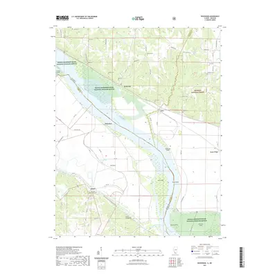
2021 Map of Rockwood
USGS Topo · Published 2021About this map
Rockwood sits at a narrow bend of the Mississippi River along the border of Illinois and Missouri, where the river's path is defined by a series of significant landmarks and bars. The landscape is heavily influenced by the drainage networks of Cinque Hommes Creek and Degognia Cr, which frame the lowlands against the elevations of Saint Cosme Hill. This area serves as a critical habitat corridor within the Middle Mississippi River National Wildlife Refuge, while the eastern portion enters the Shawnee National Forest.
Find a feature on this map
75 named features on this map. Tap any name to fly to it.
Don’t see what you’re looking for? This feature index may not catch every label — zoom into the map to look around manually.
Map Details
Editions of this 2021 Rockwood Map
This is the sole edition of this map. No revisions or reprints were ever made.
Other maps of this area

1915 · Chester
USGS Topo · 1:62,500

1916 · Campbell Hill
USGS Topo · 1:62,500

1918 · Altenburg
USGS Topo · 1:62,500

1918 · Campbell Hill
USGS Topo · 1:62,500

1923 · Perryville
USGS Topo · 1:62,500

1924 · Perryville
USGS Topo · 1:62,500

1925 · Altenburg
USGS Topo · 1:62,500

1947 · Chester
USGS Topo · 1:62,500

1947 · Crosstown
USGS Topo · 1:24,000

1947 · Altenburg
USGS Topo · 1:62,500