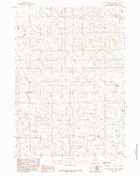
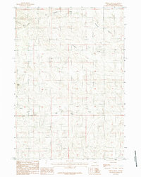
1984 Map of Rocky Butte Gulch
USGS Topo · Published 1984About this map
The Belle Fourche River winds through the northwestern corner of this Campbell County landscape, defining a terrain shaped by seasonal water management and ranching needs during the late 1970s and early 1980s. This drainage basin is characterized by ephemeral watercourses and small-scale impoundments like the Rock Butte No 2 Reservoir and the Marquiss Reservoir, which were essential for sustaining livestock in this semi-arid environment. The topography is deeply incised by the eponymous Rocky Butte Gulch, which trends southwest through the heart of the quadrangle. Further south and east, the map traces the headwaters of Hay Creek and its West Fork Hay Creek, alongside Billie Creek. A rare permanent water source, Red Spring, appears in the southeastern section, marking a vital landmark in a territory otherwise defined by dry gulches and intermittent flows.
Find a feature on this map
8 named features on this map. Tap any name to fly to it.
Don’t see what you’re looking for? This feature index may not catch every label — zoom into the map to look around manually.
Map Details
Editions of this 1984 Rocky Butte Gulch Map
2 editions found
Other maps of this area

1955 · Newcastle
USGS Topo · 1:250,000

1958 · Newcastle
USGS Topo · 1:250,000

1959 · North Star School
USGS Topo · 1:62,500

1960 · Turnercrest
USGS Topo · 1:62,500

1971 · Reno Junction
USGS Topo · 1:24,000

1971 · Little Thunder Reservoir
USGS Topo · 1:24,000
1971 · Eagle Rock
USGS Topo · 1:24,000

1974 · Reno Junction
USGS Topo · 1:100,000
1984 · Threemile Creek Reservoir
USGS Topo · 1:24,000
1984 · Persson Draw
USGS Topo · 1:24,000