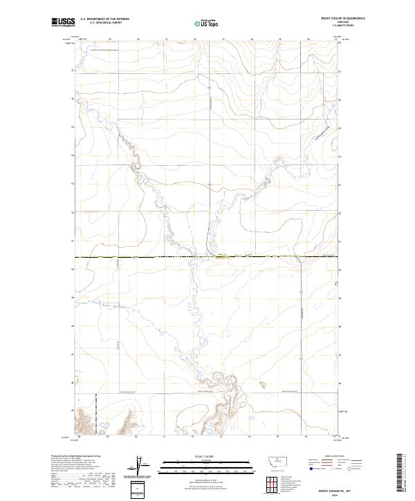
2024 Map of Rocky Coulee SE
USGS Topo · Published 2024About this map
Hill and Chouteau County borders meet in this expanse of the Montana prairie, where the landscape is defined by the winding drainages of the northern plains. The serpentine path of Black Coulee dominates the southern portion of the map, carving through the terrain near Black Coulee Rd W. Further north, the East Fork Black Coulee and Flat Coulee illustrate the complex hydraulic network of this semi-arid region. The rectangular grid of the Public Land Survey System is clearly visible through the section lines of t30n r9e and t29n r9e, reflecting the orderly division of the American West. Local transport is facilitated by a network of rural routes including Rudyard Rd S, Tiber Rd, and Boehm Rd, which provide access to the vast agricultural and grazing lands between the coulees.
Find a feature on this map
12 named features on this map. Tap any name to fly to it.
Don’t see what you’re looking for? This feature index may not catch every label — zoom into the map to look around manually.
Map Details
Editions of this 2024 Rocky Coulee SE Map
This is the sole edition of this map. No revisions or reprints were ever made.
Other maps of this area

1906 · Lonesome
USGS Topo · 1:62,500

1919 · Big Sandy
USGS Topo · 1:125,000

1954 · Shelby
USGS Topo · 1:250,000

1958 · Shelby
USGS Topo · 1:250,000

1969 · Fourteenmile Coulee SW
USGS Topo · 1:24,000

1969 · Fourteenmile Coulee NW
USGS Topo · 1:24,000
1969 · Kenilworth
USGS Topo · 1:24,000

1969 · Dutch Henry Coulee
USGS Topo · 1:24,000
1969 · Discovery Butte
USGS Topo · 1:24,000
1970 · Rocky Coulee SE
USGS Topo · 1:24,000