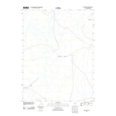
2012 Map of Rocky Pass
USGS Topo · Published 2012About this map
Waukine Ranch sits in the southwestern reaches of this high desert landscape, positioned near the waters of Carico Lake and the expanse of the Carico Lake Valley. This area of central Nevada is defined by its intermittent water sources and thermal activity, most notably at Chillis Hot Springs and Dry Hill Spring. The geography is centered on the natural gap of Rocky Pass, which serves as a transit point between the drainage of Cooks Creek to the east and the valley to the west. Roads such as Cortez Canyon Rd and Fillipini Rd provide the primary access through this remote terrain, following the natural contours of the land toward landmarks like Squaw Butte. The distribution of ranches and springs reflects the enduring importance of water management in this arid environment.
Find a feature on this map
12 named features on this map. Tap any name to fly to it.
Don’t see what you’re looking for? This feature index may not catch every label — zoom into the map to look around manually.
Map Details
Editions of this 2012 Rocky Pass Map
This is the sole edition of this map. No revisions or reprints were ever made.
Other maps of this area

1938 · Cortez
USGS Topo · 1:48,000

1944 · Cortez
USGS Topo · 1:62,500

1949 · Crescent Valley
USGS Topo · 1:62,500

1949 · Mt. Lewis
USGS Topo · 1:62,500

1950 · Mt. Lewis
USGS Topo · 1:62,500

1950 · Crescent Valley
USGS Topo · 1:62,500

1955 · Winnemucca
USGS Topo · 1:250,000

1958 · Winnemucca
USGS Topo · 1:250,000

1962 · Winnemucca
USGS Topo · 1:250,000

1962 · Carico Lake
USGS Topo · 1:62,500