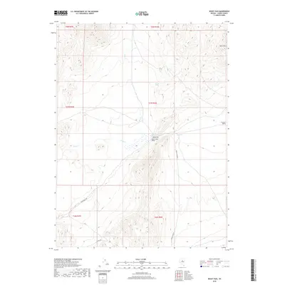
2018 Map of Rocky Pass
USGS Topo · Published 2018About this map
Rocky Pass serves as a natural transition point between the expansive basins of Carico Lake Valley and Crescent Valley in this central Nevada landscape. The area is defined by its thermal and seasonal water sources, including the notable Shoshone Hot Springs and Dry Hill Spring. These water features historically dictated the routes of local travel and livestock movement across the high desert terrain. Drainage patterns are established by Elder Cr and Cooks Cr, which navigate the slopes below landmarks like Squaw Butte. Remote transport remains anchored to a few key thoroughfares such as Cortez Canyon Rd and Fillipini Rd, which connect the disparate valleys and reflect the enduring ranching and mining infrastructure of Lander County.
Find a feature on this map
17 named features on this map. Tap any name to fly to it.
Don’t see what you’re looking for? This feature index may not catch every label — zoom into the map to look around manually.
Map Details
Editions of this 2018 Rocky Pass Map
This is the sole edition of this map. No revisions or reprints were ever made.
Other maps of this area

1938 · Cortez
USGS Topo · 1:48,000

1944 · Cortez
USGS Topo · 1:62,500

1949 · Crescent Valley
USGS Topo · 1:62,500

1949 · Mt. Lewis
USGS Topo · 1:62,500

1950 · Mt. Lewis
USGS Topo · 1:62,500

1950 · Crescent Valley
USGS Topo · 1:62,500

1955 · Winnemucca
USGS Topo · 1:250,000

1958 · Winnemucca
USGS Topo · 1:250,000

1962 · Winnemucca
USGS Topo · 1:250,000

1962 · Carico Lake
USGS Topo · 1:62,500