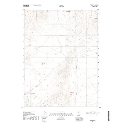
2021 Map of Rocky Pass
USGS Topo · Published 2021About this map
Rocky Pass serves as the central focal point of this high-desert landscape in Lander County, where the topography of the Shoshone Range meets the broad expanses of Carico Lake Valley and Crescent Valley. The map documents a traditional Great Basin hydrological network, anchored by Chillis Hot Springs and Dry Hill Spring, which provide critical water sources in an otherwise arid environment. The drainage patterns of Elder Cr and Cooks Cr define the movement of water through the alluvial fans at the base of the mountains. Transportation in this part of Nevada remains tied to the land's natural contours, with Cortez Canyon Rd and Carico Valley Rd tracing the valleys, while the prominent landmark of Squaw Butte stands out in the northeastern corner. This 2021 survey provides a clear view of the ranching and resource-based infrastructure, including Fillipini Rd, that supports the region's rural economy.
Find a feature on this map
17 named features on this map. Tap any name to fly to it.
Don’t see what you’re looking for? This feature index may not catch every label — zoom into the map to look around manually.
Map Details
Editions of this 2021 Rocky Pass Map
This is the sole edition of this map. No revisions or reprints were ever made.
Other maps of this area

1938 · Cortez
USGS Topo · 1:48,000

1944 · Cortez
USGS Topo · 1:62,500

1949 · Crescent Valley
USGS Topo · 1:62,500

1949 · Mt. Lewis
USGS Topo · 1:62,500

1950 · Mt. Lewis
USGS Topo · 1:62,500

1950 · Crescent Valley
USGS Topo · 1:62,500

1955 · Winnemucca
USGS Topo · 1:250,000

1958 · Winnemucca
USGS Topo · 1:250,000

1962 · Winnemucca
USGS Topo · 1:250,000

1962 · Carico Lake
USGS Topo · 1:62,500