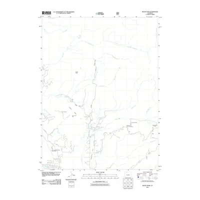
2011 Map of Rocky Peak
USGS Topo · Published 2011About this map
Routt Hot Springs and the headwaters of the Yampa River define this high-country landscape in the northern Rockies. The terrain is marked by a legacy of resource extraction, with numerous workings including the Slate Creek Mine, Copper Ridge Mine, and Soda Creek Mine scattered across the ridges. These industrial sites are juxtaposed against modern recreational and infrastructure developments, such as the Steamboat Springs-Bob Adams Field airport and the Dry Lake Campground.
Find a feature on this map
37 named features on this map. Tap any name to fly to it.
Don’t see what you’re looking for? This feature index may not catch every label — zoom into the map to look around manually.
Map Details
Editions of this 2011 Rocky Peak Map
This is the sole edition of this map. No revisions or reprints were ever made.
Other maps of this area

1911 · Hahns Peak
USGS Topo · 1:125,000

1913 · Hahns Peak
USGS Topo · 1:125,000

1954 · Craig
USGS Topo · 1:250,000

1955 · Buffalo Pass
USGS Topo · 1:24,000

1955 · Mount Ethel
USGS Topo · 1:24,000

1955 · Mount Ethel
USGS Topo · 1:62,500

1956 · Storm Mountain
USGS Topo · 1:24,000

1956 · Rabbit Ears Peak
USGS Topo · 1:62,500

1957 · Craig
USGS Topo · 1:250,000

1958 · Craig
USGS Topo · 1:250,000