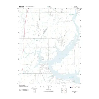
2010 Map of Rocky Point
USGS Topo · Published 2010About this map
The Neosho River dominates this landscape, winding through a series of pronounced turns including the prominent Big Bend. This 2010 survey illustrates the complex hydrography of the region, where numerous tributaries like Cat Creek, Spring Creek, and Flat Rock Creek feed into the main river channel and the Fitzgerald-Soldier Creek Site 1 Reservoir. For local historians and genealogists, the map preserves the location of the Union Mission Cemetery in the north and the Fisher Cemetery near the Oknoname 145001 Reservoir. The road network, including the specifically named Poindexter Ferry Rd, hints at historical transit points across these waterways before modern bridge infrastructure became the primary means of crossing.
Find a feature on this map
39 named features on this map. Tap any name to fly to it.
Don’t see what you’re looking for? This feature index may not catch every label — zoom into the map to look around manually.
Map Details
Editions of this 2010 Rocky Point Map
This is the sole edition of this map. No revisions or reprints were ever made.
Other maps of this area

1896 · Pryor
USGS Topo · 1:125,000

1901 · Muscogee
USGS Topo · 1:125,000

1901 · Pryor
USGS Topo · 1:125,000

1905 · Muscogee
USGS Topo · 1:125,000

1946 · Fort Smith
USGS Topo · 1:250,000

1948 · Hulbert
USGS Topo · 1:62,500

1948 · Wagoner
USGS Topo · 1:62,500

1950 · Wagoner
USGS Topo · 1:62,500

1950 · Hulbert
USGS Topo · 1:62,500

1954 · Tulsa
USGS Topo · 1:250,000