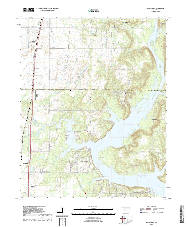
2022 Map of Rocky Point
USGS Topo · Published 2022About this map
Neosho River and the expansive Fort Gibson Lake define the landscape of this section of Mayes and Wagoner Counties. The map captures a transition between the elevated uplands and the water-dominated geography of Flat Rock Bay and Big Bend. Along the western corridor, the Union Pacific RR runs parallel to US Hwy 69, anchoring the settlements of Mazie and Leliaetta. These transport routes provide a sharp contrast to the more secluded residential developments such as Pin Oak Acres and Yonkers that overlook the river valley.
Find a feature on this map
99 named features on this map. Tap any name to fly to it.
Don’t see what you’re looking for? This feature index may not catch every label — zoom into the map to look around manually.
Map Details
Editions of this 2022 Rocky Point Map
This is the sole edition of this map. No revisions or reprints were ever made.
Other maps of this area

1896 · Pryor
USGS Topo · 1:125,000

1901 · Muscogee
USGS Topo · 1:125,000

1901 · Pryor
USGS Topo · 1:125,000

1905 · Muscogee
USGS Topo · 1:125,000

1946 · Fort Smith
USGS Topo · 1:250,000

1948 · Hulbert
USGS Topo · 1:62,500

1948 · Wagoner
USGS Topo · 1:62,500

1950 · Wagoner
USGS Topo · 1:62,500

1950 · Hulbert
USGS Topo · 1:62,500

1954 · Tulsa
USGS Topo · 1:250,000