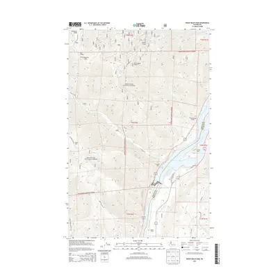
2014 Map of Rocky Reach Dam
USGS Topo · Published 2014About this map
Rocky Reach Dam serves as the central landmark for this stretch of the Columbia River north of Wenatchee. The landscape is defined by the contrast between the reservoir waters of Lake Entiat and the sharp rising slopes of the Entiat Mountains to the west. Within the protected boundaries of the Wenatchee National Forest, several canyons and ridges dominate the topography, including Spencer Canyon and Burch Mtn. Settlement is concentrated on the narrow benches above the river, most notably at Zena and Baker Flats. This 2014 survey documents the modern road network, from highway access near Lincoln Rock to forest service routes like Nat For Dev Rd 7415 that penetrate the high country. Natural features such as Turtle Rock and the drainage of Swakane Cr remain prominent fixtures along this managed waterway.
Find a feature on this map
36 named features on this map. Tap any name to fly to it.
Don’t see what you’re looking for? This feature index may not catch every label — zoom into the map to look around manually.
Map Details
Editions of this 2014 Rocky Reach Dam Map
This is the sole edition of this map. No revisions or reprints were ever made.
Other maps of this area

1901 · Chelan
USGS Topo · 1:125,000

1912 · Malaga
USGS Topo · 1:48,000

1913 · Wenatchee
USGS Topo · 1:62,500

1914 · Malaga
USGS Topo · 1:62,500

1915 · Wenatchee
USGS Topo · 1:62,500

1920 · Colockum Pass
USGS Topo · 1:125,000

1922 · Colockum Pass
USGS Topo · 1:125,000

1957 · Wenatchee
USGS Topo · 1:250,000

1966 · Rock Island
USGS Topo · 1:24,000

1966 · Wenatchee
USGS Topo · 1:24,000