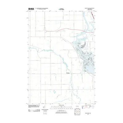
2010 Map of Rocky Run
USGS Topo · Published 2010About this map
Wisconsin River dominates the eastern landscape of this 2010 survey, creating a complex network of channels and inlets near Rocky Run. The terrain is defined by the convergence of several waterways, including Mill Creek and Bear Creek, which wind through the southern and western portions of the quadrangle. This area in Portage County reflects a mix of rural residential development and significant water features, most notably First Lake and the various islands within the river's main course.
Find a feature on this map
52 named features on this map. Tap any name to fly to it.
Don’t see what you’re looking for? This feature index may not catch every label — zoom into the map to look around manually.
Map Details
Editions of this 2010 Rocky Run Map
This is the sole edition of this map. No revisions or reprints were ever made.
Other maps of this area

1955 · Green Bay
USGS Topo · 1:250,000

1956 · Milladore
USGS Topo · 1:48,000

1956 · Stevens Point
USGS Topo · 1:48,000

1957 · Wisconsin Rapids
USGS Topo · 1:48,000

1957 · Whiting
USGS Topo · 1:48,000

1967 · Wisconsin Rapids
USGS Topo · 1:62,500

1970 · Junction City
USGS Topo · 1:24,000

1970 · Stevens Point
USGS Topo · 1:24,000
1970 · Rocky Run
USGS Topo · 1:24,000
1970 · Meehan
USGS Topo · 1:24,000