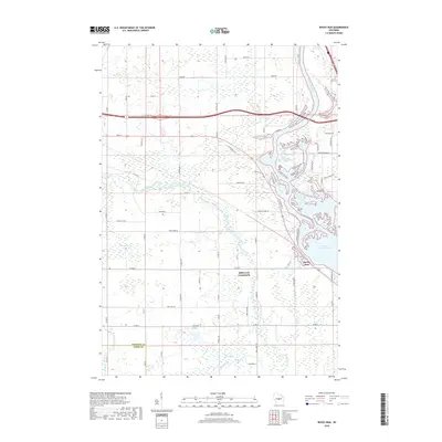
2018 Map of Rocky Run
USGS Topo · Published 2018About this map
The Wisconsin River dominates the eastern edge of this Portage County landscape, its course widened into the Wisconsin River Flowage which reaches into the land with numerous finger-like inlets. The settlement of Rocky Run sits at the edge of this water system, while the Mill Creek Community occupies the central interior near the confluence of local drainages. The terrain is characterized by extensive wetland systems, most notably Fogarty Marsh in the west and Bear Creek Marsh to the south. These low-lying areas are fed by winding waterways like Mill Creek and Bear Creek, which cut through a network of rural roads such as Oak Hill Rd and Co Rd M. This survey illustrates the modern intersection of hydraulic management and rural residential patterns along the river valley.
Find a feature on this map
62 named features on this map. Tap any name to fly to it.
Don’t see what you’re looking for? This feature index may not catch every label — zoom into the map to look around manually.
Map Details
Editions of this 2018 Rocky Run Map
This is the sole edition of this map. No revisions or reprints were ever made.
Other maps of this area

1955 · Green Bay
USGS Topo · 1:250,000

1956 · Milladore
USGS Topo · 1:48,000

1956 · Stevens Point
USGS Topo · 1:48,000

1957 · Wisconsin Rapids
USGS Topo · 1:48,000

1957 · Whiting
USGS Topo · 1:48,000

1967 · Wisconsin Rapids
USGS Topo · 1:62,500

1970 · Junction City
USGS Topo · 1:24,000

1970 · Stevens Point
USGS Topo · 1:24,000
1970 · Rocky Run
USGS Topo · 1:24,000
1970 · Meehan
USGS Topo · 1:24,000