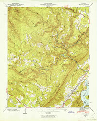
1946 Map of Roddy
USGS Topo · Published 1962About this map
The Cumberland Escarpment dominates this 1946 field-examined landscape, where the jagged border of Cumberland, Rhea, and Roane Counties meets at the dramatic relief of Shinbone and Hampton Ridge. Along the southeastern edge, the Southern Railway and Highway 27 parallel the shores of Watts Bar Lake, connecting the settlement of Roddy to the broader Tennessee Valley.
Find a feature on this map
106 named features on this map. Tap any name to fly to it.
Don’t see what you’re looking for? This feature index may not catch every label — zoom into the map to look around manually.
Map Details
Editions of this 1946 Roddy Map
2 editions found

Other maps of this area

1887 · Kingston
USGS Topo · 1:125,000

1891 · Kingston
USGS Topo · 1:125,000

1893 · Kingston
USGS Topo · 1:125,000

1935 · Rockwood
USGS Topo · 1:24,000

1935 · Pennine
USGS Topo · 1:24,000

1936 · Roddy
USGS Topo · 1:24,000
1936 · Ozone
USGS Topo · 1:24,000

1936 · Cardiff
USGS Topo · 1:24,000

1936 · Spring City
USGS Topo · 1:24,000
1936 · Grassy Cove
USGS Topo · 1:24,000