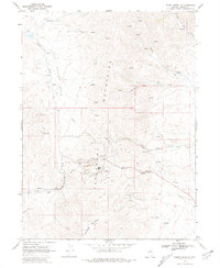
1968 Map of Rodeo Creek NE
USGS Topo · Published 1981About this map
The Tuscarora Mountains dominate this 1968 landscape in northern Nevada, showcasing a region defined by industrial-scale mineral extraction. At the heart of the terrain lies the Carlin Mine, a site that would become synonymous with one of the most significant gold deposits in the world. The map meticulously records the heavy infrastructure required for these operations, including an extensive Aqueduct system, a Tailings Pond, and specialized sites like the Blue Star Mine and Big Six Mine. These features illustrate the transformation of the high desert as mining transformed the earth near Popovich Hill and Richmond Mountain. Away from the industrial hubs, the land is punctuated by isolated Corrals and numerous seasonal water sources such as Little Indian Creek and Cottonwood Creek, reflecting the traditional ranching heritage that exists alongside the massive open-pit mining operations in Boulder Basin.
Find a feature on this map
26 named features on this map. Tap any name to fly to it.
Don’t see what you’re looking for? This feature index may not catch every label — zoom into the map to look around manually.
Map Details
Editions of this 1968 Rodeo Creek NE Map
2 editions found
Other maps of this area

1955 · McDermitt
USGS Topo · 1:250,000

1955 · Winnemucca
USGS Topo · 1:250,000

1958 · Winnemucca
USGS Topo · 1:250,000

1959 · McDermitt
USGS Topo · 1:250,000

1962 · Winnemucca
USGS Topo · 1:250,000

1968 · Rodeo Creek SW
USGS Topo · 1:24,000

1968 · Rodeo Creek NE
USGS Topo · 1:24,000

1968 · Welches Canyon
USGS Topo · 1:24,000

1968 · Swales Mountain NW
USGS Topo · 1:24,000

1968 · Rodeo Creek NW
USGS Topo · 1:24,000