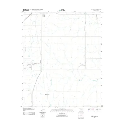
2012 Map of Roff South
USGS Topo · Published 2012About this map
Hickory and Scullin anchor the western portion of this rural Pontotoc County landscape, where the open country is defined by an intricate network of drainage. The area is characterized by the headwaters and winding paths of the Blue River, Pennington Cr, and Little W Blue Cr, which together create a complex hydrological pattern across the terrain. Small settlements and specialized land use, such as Winrock Farms, are connected by a grid of county roads and the more modern passage of Chickasaw Tpke S. Local history is preserved at sites like Hickory Cem and Scullin Cem, which serve as quiet landmarks for genealogists and researchers looking into the community's past. The map also captures the smaller residential clusters of Denny and the residential street grid of Hickory, including Madison St and Chestnut St, offering a detailed view of these rural Oklahoma outposts during the early 21st century.
Find a feature on this map
38 named features on this map. Tap any name to fly to it.
Don’t see what you’re looking for? This feature index may not catch every label — zoom into the map to look around manually.
Map Details
Editions of this 2012 Roff South Map
This is the sole edition of this map. No revisions or reprints were ever made.
Other maps of this area

1901 · Stonewall
USGS Topo · 1:125,000

1901 · Tishomingo
USGS Topo · 1:125,000

1957 · Ardmore
USGS Topo · 1:250,000

1963 · Ardmore
USGS Topo · 1:250,000

1963 · Sulphur South
USGS Topo · 1:24,000

1963 · Mill Creek
USGS Topo · 1:24,000

1967 · Roff South
USGS Topo · 1:24,000

1967 · Ahloso
USGS Topo · 1:24,000

1967 · Connerville
USGS Topo · 1:24,000

1967 · Roff North
USGS Topo · 1:24,000