
1967 Map of Ahloso
USGS Topo · Published 1968About this map
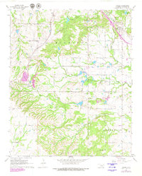
St Louis-San Francisco and Atchison Topeka and Santa Fe railroad lines converge toward the northern reaches of this Pontotoc County landscape, framing the small settlements of Ahloso and Latta. The terrain is defined by the headwaters of several major waterways, including Clear Boggy Creek and the North Fork and South Fork of unnamed branches, which carve through the Chickasaw lands. The presence of the West Fitts Oil Field in the south and various quarries and shale pits near Lawrence points to an economy rooted in natural resource extraction. Local history and genealogy are anchored by several landmarks, such as the High Hill Ch, Hickory Hill Ch, and Puller Cem. Of modern scientific interest is the Kerr Research Center, located near an aqueduct that cuts across the central hills.
Find a feature on this map
21 named features on this map. Tap any name to fly to it.
Don’t see what you’re looking for? This feature index may not catch every label — zoom into the map to look around manually.
Map Details
Editions of this 1967 Ahloso Map
2 editions found
Other maps of this area

1901 · Stonewall
USGS Topo · 1:125,000

1957 · Stonewall
USGS Topo · 1:24,000

1957 · Ardmore
USGS Topo · 1:250,000

1958 · Francis
USGS Topo · 1:24,000

1958 · Ada
USGS Topo · 1:24,000

1963 · Ardmore
USGS Topo · 1:250,000
1966 · Harden City
USGS Topo · 1:24,000

1967 · Roff South
USGS Topo · 1:24,000
1967 · Vanoss
USGS Topo · 1:24,000

1967 · Roff North
USGS Topo · 1:24,000