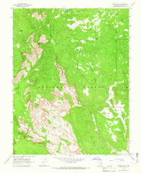
1964 Map of Roger Peak
USGS Topo · Published 1966About this map
Hells Backbone and the dramatic drop-offs of Death Hollow dominate this mid-1960s survey of the high desert plateau. The landscape is defined by the sharp transition between the timbered heights of the Dixie National Forest and the deeply incised drainages of the Right Fork. Human presence is minimal, evidenced by the King Ranch situated near the confluence of King Creek and Sweetwater Creek. This period captures the area's transition into a more accessible backcountry, with a network of Jeep Trails and Pack Trails winding past McCath Lake and Donkey Lake. Geologic interest is noted by a Drill Hole near Roger Peak and a Gravel Pit along the high ridges, while the broader topography shows the stark flats of King Bench and Slickrock Saddle Bench stretching toward the horizon.
Find a feature on this map
25 named features on this map. Tap any name to fly to it.
Don’t see what you’re looking for? This feature index may not catch every label — zoom into the map to look around manually.
Map Details
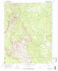
Editions of this 1964 Roger Peak Map
2 editions found
Other maps of this area

1885 · Fish Lake
USGS Topo · 1:250,000

1886 · Escalante
USGS Topo · 1:250,000

1896 · Fish Lake
USGS Topo · 1:250,000

1952 · Notom 3 SW
USGS Topo · 1:24,000

1952 · Grover
USGS Topo · 1:62,500

1956 · Escalante
USGS Topo · 1:250,000

1956 · Salina
USGS Topo · 1:250,000

1960 · Escalante
USGS Topo · 1:250,000

1960 · Salina
USGS Topo · 1:250,000

1962 · Salina
USGS Topo · 1:250,000