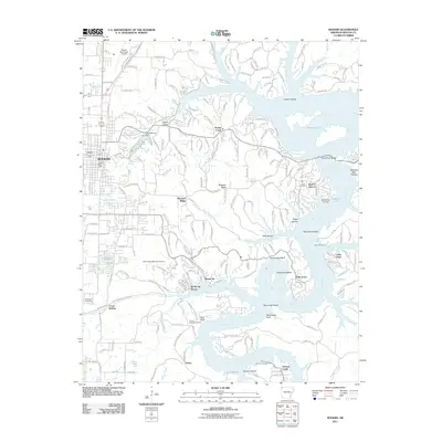
2011 Map of Rogers
USGS Topo · Published 2011About this map
Rogers serves as the western anchor of this survey, where urban development meets the extensive waters of Beaver Lake. The landscape is defined by the winding course of the White River and the many hollows that feed it, including Coose Hollow and Sugar Hollow. The 2011 data shows a region transitioning from the dense street grids of the city to the recreational and residential developments along the shoreline, such as Beaver Shores and Monte Ne Shores.
Find a feature on this map
48 named features on this map. Tap any name to fly to it.
Don’t see what you’re looking for? This feature index may not catch every label — zoom into the map to look around manually.
Map Details
Editions of this 2011 Rogers Map
This is the sole edition of this map. No revisions or reprints were ever made.
Other maps of this area

1899 · Fayetteville
USGS Topo · 1:125,000

1900 · Eureka Springs
USGS Topo · 1:125,000

1901 · Eureka Springs
USGS Topo · 1:125,000

1901 · Fayetteville
USGS Topo · 1:125,000

1904 · Fayetteville
USGS Topo · 1:125,000

1945 · Harrison
USGS Topo · 1:250,000

1949 · Harrison
USGS Topo · 1:250,000

1954 · Harrison
USGS Topo · 1:250,000

1954 · Tulsa
USGS Topo · 1:250,000

1957 · War Eagle
USGS Topo · 1:24,000