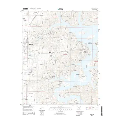
2014 Map of Rogers
USGS Topo · Published 2014About this map
The growing city of Rogers serves as the focal point for this survey of Benton County, where the street grid of the city proper meets the expansive waters of Beaver Lake. The map documents a diverse landscape of residential development and preserved natural features, including the recreation areas around Lake Atalanta and the unique geography of Monte Ne. Along the shores of the reservoir, communities like Prairie Creek, Beaver Shores, and Monte Ne Shores illustrate the post-dam era of settlement in Northwest Arkansas.
Find a feature on this map
208 named features on this map. Tap any name to fly to it.
Don’t see what you’re looking for? This feature index may not catch every label — zoom into the map to look around manually.
Map Details
Editions of this 2014 Rogers Map
This is the sole edition of this map. No revisions or reprints were ever made.
Other maps of this area

1899 · Fayetteville
USGS Topo · 1:125,000

1900 · Eureka Springs
USGS Topo · 1:125,000

1901 · Eureka Springs
USGS Topo · 1:125,000

1901 · Fayetteville
USGS Topo · 1:125,000

1904 · Fayetteville
USGS Topo · 1:125,000

1945 · Harrison
USGS Topo · 1:250,000

1949 · Harrison
USGS Topo · 1:250,000

1954 · Harrison
USGS Topo · 1:250,000

1954 · Tulsa
USGS Topo · 1:250,000

1957 · War Eagle
USGS Topo · 1:24,000