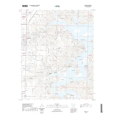
2020 Map of Rogers
USGS Topo · Published 2020About this map
Beaver Lake dominates the eastern half of this terrain, its convoluted shoreline defining the modern character of Benton County. The map documents the intricate interface between suburban expansion and the Ozark topography, where residential developments like Monte Ne Shores and Beaver Shores occupy the ridges above the water. A notable historical layer is present at Monte Ne, the site of a once-famed resort area now partially submerged by the lake's creation. Significant genealogical data is preserved through several rural burial grounds, including Frisco Springs Cem and McDaniel Cem. The transition from the urban grid of Rogers and Lowell in the west to the deep hollows and bluffs of the east, such as Devils Head Bluff and McElhaney Bluff, illustrates the regional geography before the most recent decade of rapid growth.
Find a feature on this map
131 named features on this map. Tap any name to fly to it.
Don’t see what you’re looking for? This feature index may not catch every label — zoom into the map to look around manually.
Map Details
Editions of this 2020 Rogers Map
This is the sole edition of this map. No revisions or reprints were ever made.
Other maps of this area

1899 · Fayetteville
USGS Topo · 1:125,000

1900 · Eureka Springs
USGS Topo · 1:125,000

1901 · Eureka Springs
USGS Topo · 1:125,000

1901 · Fayetteville
USGS Topo · 1:125,000

1904 · Fayetteville
USGS Topo · 1:125,000

1945 · Harrison
USGS Topo · 1:250,000

1949 · Harrison
USGS Topo · 1:250,000

1954 · Harrison
USGS Topo · 1:250,000

1954 · Tulsa
USGS Topo · 1:250,000

1957 · War Eagle
USGS Topo · 1:24,000