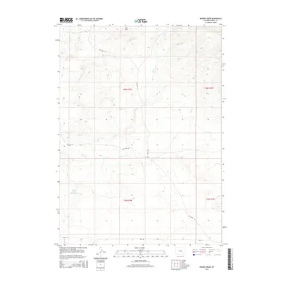
2015 Map of Rogers Creek
USGS Topo · Published 2015About this map
Mine Hills anchor the northern landscape of this Albany County quadrangle, where the terrain is defined by a network of drainage systems and high-elevation range land. The mapping reveals a rural landscape focused on livestock management, notably marked by the Grazing Number 1 Stock Reservoir in the western section. Transport through this area relies on a series of functional routes, including Mule Creek Rd, Sheep Creek Rd, and Tower Rd, which cut across the varied topography. Waterways such as Mule Cr and Rogers Cr provide the primary natural drainage for the high plains, illustrating the water-scarce environment of Wyoming's interior during the early 21st century. The map provides clear evidence of how the public land survey system organizes this territory into townships and ranges, such as t26n r75w, facilitating grazing and land use across the watershed.
Find a feature on this map
11 named features on this map. Tap any name to fly to it.
Don’t see what you’re looking for? This feature index may not catch every label — zoom into the map to look around manually.
Map Details
Editions of this 2015 Rogers Creek Map
This is the sole edition of this map. No revisions or reprints were ever made.
Other maps of this area

1954 · Torrington
USGS Topo · 1:250,000

1958 · Torrington
USGS Topo · 1:250,000

1964 · Toltec
USGS Topo · 1:24,000
1964 · Pass Creek
USGS Topo · 1:24,000

1964 · Marshall
USGS Topo · 1:24,000

1968 · Cottonwood Creek
USGS Topo · 1:24,000
1968 · Boot Heel
USGS Topo · 1:24,000
1968 · Greasewood Knoll
USGS Topo · 1:24,000
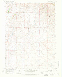
1968 · Rogers Creek
USGS Topo · 1:24,000
1968 · Boot Heel SE
USGS Topo · 1:24,000