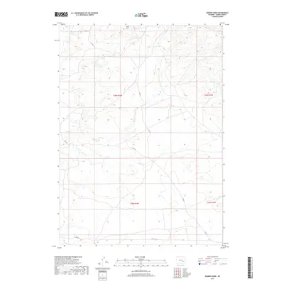
2017 Map of Rogers Creek
USGS Topo · Published 2017About this map
Mine Hills anchor the northern reaches of this Albany County landscape, rising above a network of seasonal drainages and high-plains terrain. This 2017 survey reflects the enduring cattle-country infrastructure of Wyoming, where access is defined by remote corridors like Co Rd 64 and Tower Rd. The land is carved by the intermittent flows of Mule Cr and Rogers Cr, which weave through a grid of section lines that still dictate the rural spatial organization of the region. This particular quadrangle illustrates the intersection of several townships, including t26n r75w and t25n r74w, providing a clear view of the public land survey system that governs this part of the American West. The lack of dense settlement emphasizes the open-range character of the territory, preserved here in high detail.
Find a feature on this map
10 named features on this map. Tap any name to fly to it.
Don’t see what you’re looking for? This feature index may not catch every label — zoom into the map to look around manually.
Map Details
Editions of this 2017 Rogers Creek Map
This is the sole edition of this map. No revisions or reprints were ever made.
Other maps of this area

1954 · Torrington
USGS Topo · 1:250,000

1958 · Torrington
USGS Topo · 1:250,000

1964 · Toltec
USGS Topo · 1:24,000
1964 · Pass Creek
USGS Topo · 1:24,000

1964 · Marshall
USGS Topo · 1:24,000

1968 · Cottonwood Creek
USGS Topo · 1:24,000
1968 · Boot Heel
USGS Topo · 1:24,000
1968 · Greasewood Knoll
USGS Topo · 1:24,000
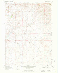
1968 · Rogers Creek
USGS Topo · 1:24,000
1968 · Boot Heel SE
USGS Topo · 1:24,000