
1965 Map of Rogers Ruins
USGS Topo · Published 1968About this map
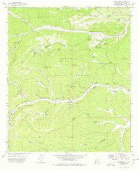
Lincoln National Forest dominates the terrain of Otero County in the mid-1960s, defined by a complex network of canyons and established ranching outposts. The namesake Rogers Ruins sits near the head of Logan Canyon, while family-named landmarks like Fairchild Ranch and Circle Cross Ranch are situated along the winding course of the Sacramento River. The landscape is a high-altitude wilderness where water sources were critical to settlement, evidenced by the numerous named points such as Sulfur Spring, Carrisa Spring, and Monument Spring.
Find a feature on this map
43 named features on this map. Tap any name to fly to it.
Don’t see what you’re looking for? This feature index may not catch every label — zoom into the map to look around manually.
Map Details
Editions of this 1965 Rogers Ruins Map
This is the sole edition of this map. No revisions or reprints were ever made.
Other maps of this area

1950 · Escondido Canyon
USGS Topo · 1:62,500

1950 · Alamogordo
USGS Topo · 1:62,500

1952 · Cloudcroft
USGS Topo · 1:62,500

1954 · Carlsbad
USGS Topo · 1:250,000

1958 · Carlsbad
USGS Topo · 1:250,000

1965 · Bear Spring
USGS Topo · 1:24,000

1965 · Surveyors Canyon
USGS Topo · 1:24,000

1965 · El Paso Canyon
USGS Topo · 1:24,000
1974 · Sacramento
USGS Topo · 1:24,000
1974 · Bluff Springs
USGS Topo · 1:24,000