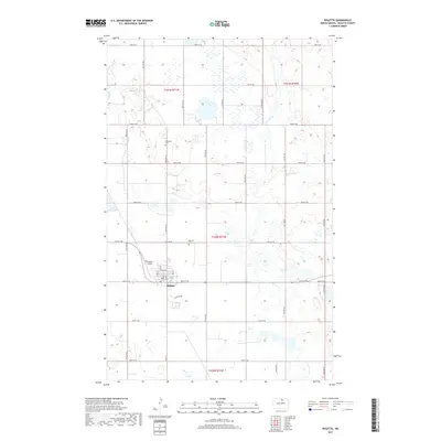
2017 Map of Rolette
USGS Topo · Published 2017About this map
Rolette serves as the primary hub in this portion of Rolette County, characterized by a highly structured grid of section lines and agricultural roads. The town's layout is centered on Main St and State St, with the Rolette Airport and Rolette Cem positioned on the outskirts. Further north, the landscape is dotted with numerous small wetlands and prairie potholes typical of the region, including Little Gurr Lake. Small local landmarks such as Westland Cem are preserved within these agricultural townships, providing specific points of interest for those tracing family roots in the area. The drainage pattern is defined by the winding paths of Wolf Cr and Ox Cr, which cut across the otherwise rectilinear road network of numbered streets and avenues.
Find a feature on this map
31 named features on this map. Tap any name to fly to it.
Don’t see what you’re looking for? This feature index may not catch every label — zoom into the map to look around manually.
Map Details
Editions of this 2017 Rolette Map
This is the sole edition of this map. No revisions or reprints were ever made.
Other maps of this area

1936 · Lake Upsilon
USGS Topo · 1:48,000

1942 · Lake Upsilon
USGS Topo · 1:62,500

1953 · Devils Lake
USGS Topo · 1:250,000

1955 · Thorne
USGS Topo · 1:24,000

1955 · Rolette SW
USGS Topo · 1:24,000

1955 · Lake Upsilon SW
USGS Topo · 1:24,000

1956 · Devils Lake
USGS Topo · 1:250,000

1968 · Lake Upsilon SE
USGS Topo · 1:24,000

1968 · Belcourt
USGS Topo · 1:24,000

1971 · Island Lake
USGS Topo · 1:24,000