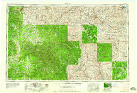
1959 Map of Rolla
USGS Topo · Published 1959About this map
The Ozark Mountains define the character of this mid-century Missouri landscape, where the heavy timber of the Mark Twain National Forest and Clark National Forest spans several counties. Centered on the educational and transit hub of Rolla, the map documents a transition from the rolling hills of the west to the ancient, granite peaks of the St Francois Mountains in the east. This eastern section is marked by industrial activity and conservation, featuring the lead-mining district near Bonne Terre and Flat River alongside preserved lands like Johnson's Shut-ins State Park and Sam A Baker State Park.
Find a feature on this map
110 named features on this map. Tap any name to fly to it.
Don’t see what you’re looking for? This feature index may not catch every label — zoom into the map to look around manually.
Map Details
Editions of this 1959 Rolla Map
This is the sole edition of this map. No revisions or reprints were ever made.
Other maps of this area

1888 · Tuscumbia
USGS Topo · 1:125,000

1894 · Tuscumbia
USGS Topo · 1:125,000

1901 · De Soto
USGS Topo · 1:125,000

1903 · Sullivan
USGS Topo · 1:125,000

1904 · Farmington
USGS Topo · 1:62,500

1905 · Bonneterre
USGS Topo · 1:62,500

1906 · Potosi
USGS Topo · 1:62,500

1906 · Farmington
USGS Topo · 1:62,500

1907 · Weingarten
USGS Topo · 1:62,500

1909 · Weingarten
USGS Topo · 1:62,500