
1966 Map of Rolla
USGS Topo · Published 1966About this map
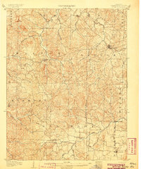
Rolla and the surrounding Ozark Plateau are documented here during a period of mid-century growth and conservation. The landscape is heavily defined by the massive tracts of the Mark Twain National Forest and Clark National Forest, which surround established mining and timber hubs like Salem, Steelville, and Piedmont. In the eastern portion of the map, the Saint Francois Mountains rise above the Lead Belt, where Flat River and Desloge mark a region of intense mineral extraction.
Find a feature on this map
105 named features on this map. Tap any name to fly to it.
Don’t see what you’re looking for? This feature index may not catch every label — zoom into the map to look around manually.
Map Details
Editions of this 1966 Rolla Map
This is the sole edition of this map. No revisions or reprints were ever made.
Other maps of this area

1888 · Tuscumbia
USGS Topo · 1:125,000

1894 · Tuscumbia
USGS Topo · 1:125,000

1901 · De Soto
USGS Topo · 1:125,000

1903 · Sullivan
USGS Topo · 1:125,000

1904 · Farmington
USGS Topo · 1:62,500

1905 · Bonneterre
USGS Topo · 1:62,500
1906 · Potosi
USGS Topo · 1:62,500

1906 · Farmington
USGS Topo · 1:62,500

1907 · Weingarten
USGS Topo · 1:62,500

1909 · Weingarten
USGS Topo · 1:62,500