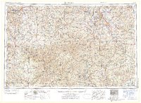
1971 Map of Rolla
USGS Topo · Published 1971About this map
Taum Sauk Mountain and the surrounding St Francois Mountains anchor this detailed study of south-central Missouri, a region defined by its rugged topography and industrial history. The map highlights the extensive mining operations that shaped the local economy, including the St Joseph Mines, Mine La Motte, and the Schulte Mine near Fredericktown. These mineral deposits are intersected by the critical transport lines of the St Louis-San Francisco Ry and the Missouri Pacific RR, which facilitated the movement of timber and ore.
Find a feature on this map
67 named features on this map. Tap any name to fly to it.
Don’t see what you’re looking for? This feature index may not catch every label — zoom into the map to look around manually.
Map Details
Editions of this 1971 Rolla Map
This is the sole edition of this map. No revisions or reprints were ever made.
Other maps of this area

1888 · Tuscumbia
USGS Topo · 1:125,000

1894 · Tuscumbia
USGS Topo · 1:125,000

1901 · De Soto
USGS Topo · 1:125,000

1903 · Sullivan
USGS Topo · 1:125,000

1904 · Farmington
USGS Topo · 1:62,500

1905 · Bonneterre
USGS Topo · 1:62,500

1906 · Potosi
USGS Topo · 1:62,500

1906 · Farmington
USGS Topo · 1:62,500

1907 · Weingarten
USGS Topo · 1:62,500

1909 · Weingarten
USGS Topo · 1:62,500