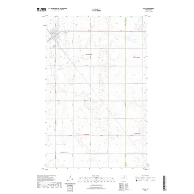
2020 Map of Rolla
USGS Topo · Published 2020About this map
The Rolette County Courthouse stands as the central landmark of Rolla, the county seat situated in the northern reaches of North Dakota. This modern topographical study highlights the town's grid, anchored by Main Ave E and Main Ave W, while documenting vital local history sites including the Rolla Cem and Saint Michael church. Beyond the residential center, the landscape transitions into the characteristic pothole region of the northern plains, marked by the prominent Big Coulee drainage that winds through the prairie.
Find a feature on this map
36 named features on this map. Tap any name to fly to it.
Don’t see what you’re looking for? This feature index may not catch every label — zoom into the map to look around manually.
Map Details
Editions of this 2020 Rolla Map
This is the sole edition of this map. No revisions or reprints were ever made.
Other maps of this area

1953 · Devils Lake
USGS Topo · 1:250,000

1956 · Devils Lake
USGS Topo · 1:250,000

1968 · Belcourt
USGS Topo · 1:24,000
1969 · Hansboro
USGS Topo · 1:24,000

1969 · Saint John
USGS Topo · 1:24,000

1969 · Rolla NE
USGS Topo · 1:24,000

1970 · Hansboro SW
USGS Topo · 1:24,000

1970 · Rolla
USGS Topo · 1:24,000

1971 · Mylo
USGS Topo · 1:24,000

1971 · Bisbee North
USGS Topo · 1:24,000